Posts tagged ‘Rio Grande River’
Big Bend National Park – Vol 3
Warning: Use of undefined constant gad_content_tag_filter_replace - assumed 'gad_content_tag_filter_replace' (this will throw an Error in a future version of PHP) in /home/dx87kwtjkt0i/public_html/wp-content/plugins/web-ninja-google-analytics/webninja_ga.php on line 1813
The Chihuahuan Desert, a rugged place of snakes, cacti, ragged geology, heat, & thirst. Some years it has looked burnt over. Those were drought years.
This year at this time the predominantly brown-orange-yellow-red paletted desert has a lot of green and multi-hued blooms, small and big.
Apparently it is all about timing (and water).
 North America has four deserts: Great Basin, Mojave, Sonoran and the Chihuahuan, which extends deep into Mexico. Big Bend National Park lies in its northern third. Mountains that block rain border the Chihuahuan Desert on three sides. Its other side abuts vast semi-arid plains.
 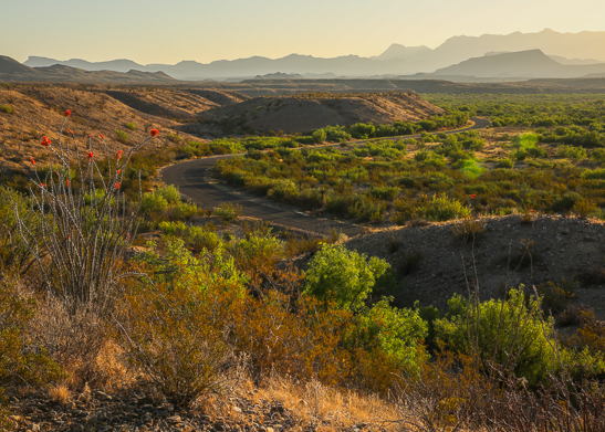 This young desert is about 8,000 years old.
 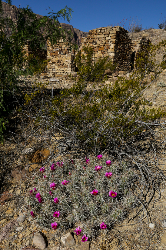 Green and fairly lush, its rainfall comes mostly in the July to October monsoon. Its rain and clouds can mean far cooler temperatures than one might expect in a desert. Heat and seasonal winds increase aridity. Summer ground temperatures may be 180 degrees F at mid-day – or freezing in winter as northern storms sweep through.
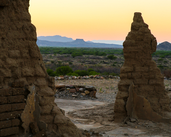
An Jacal ( \hə-ˈkäl\ ) a hut in Mexico and southwestern United States with a thatched roof and walls made of upright poles or sticks covered and chinked with mud or clay.
Out on the Old Maverick Road.
Big Bend has lots of high-clearance back roads, ranch roads. Great way to access the history and culture of the Chihuahuan Desert.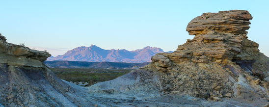 Sunrise light on the Chisos Mountains through the hoodoos out in the Chihuahuan Desert.
Expanded Big Bend NP Image Gallery
Big Bend National Park – Vol 1
Big Bend National Park – Vol 2
Big Bend NP Brochure, National Park Service, U.S. Department of the Interior
Big Bend National Park ~ Vol 2
Warning: Use of undefined constant gad_content_tag_filter_replace - assumed 'gad_content_tag_filter_replace' (this will throw an Error in a future version of PHP) in /home/dx87kwtjkt0i/public_html/wp-content/plugins/web-ninja-google-analytics/webninja_ga.php on line 1813
Riparian ecosystems : green fingers of dense vegetation stand out against the sparse greenish brown-yellow-red-orange vegetation of the desert.
The Rio Grande is no longer that. Some but very little moving water graces it channel. The Mexicans who lay claim to its tributary waters upstream recognize it not as the Rio Grande but as the Rio Bravo.

 Big Bend refers to the great southwest Texas U-turn the Rio Grande makes here – defining the Park boundary, the State of Texas, and the Mexican-US boundary for 118 miles. The river is an arcing linear oasis, a ribbon of green that cuts across the dry desert and carves deep canyons. Like all rivers surviving desert passages, it has its headwaters outside this desert, in Colorado. Irrigation, dams, agriculture, manufacturing, exotic plants and evaporation sap most of the Rio Grande’s water before it gets to the Park. In the Park the river’s water mostly comes from Mexico’s Rio Conchos.
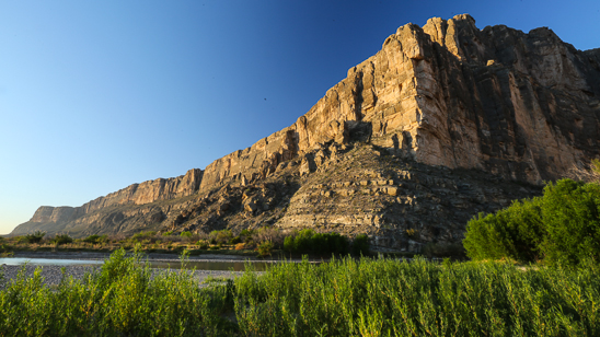
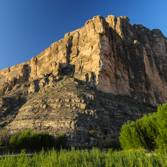
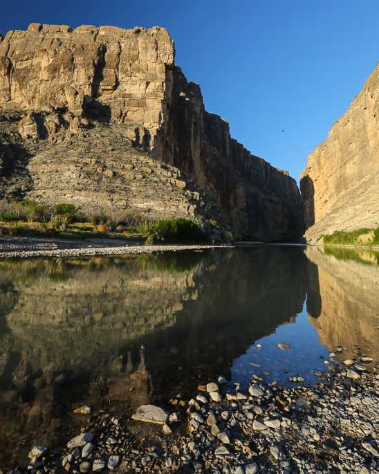
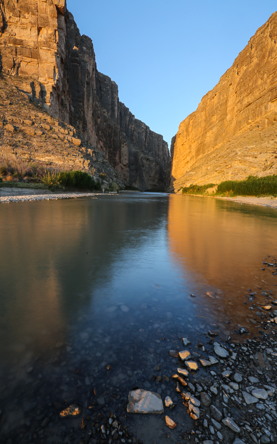
The images above were captured at the mouth of the Santa Elena Canyon on the border in the western portion of the Park.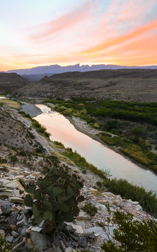
Sunrise capture looking East into and towards the Sierra del Carmen and Boquillas Canyon in the eastern portion of the Park.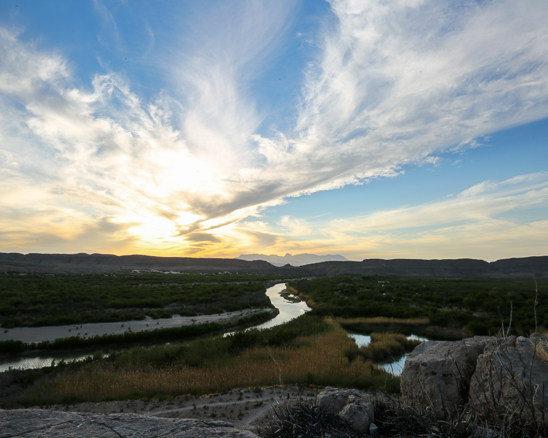
The river creates an oasis for species not adapted to arid desert life, adding to the Park’s biological diversity. Its thin flood plain looks like a green belt in the desert. River sand and gravel bars and cliff banks host creatures not expected in the Chihuahian Desert. 
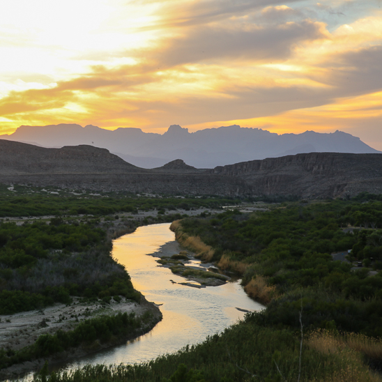 Sunset captures looking west over the Rio Grande from outside Boquillas Canyon towards the Chisos Mountain Range.
Expanded Big Bend NP Image Gallery
Big Bend National Park – Vol 1
Big Bend NP Brochure, National Park Service, U.S. Department of the Interior
Big Bend National Park ~ Vol 1
Warning: Use of undefined constant gad_content_tag_filter_replace - assumed 'gad_content_tag_filter_replace' (this will throw an Error in a future version of PHP) in /home/dx87kwtjkt0i/public_html/wp-content/plugins/web-ninja-google-analytics/webninja_ga.php on line 1813
Big Bend National Park
A vast and rugged place: Chihuahuan Desert. Rio Grande River Valley, and the Chisos Mountains.
Also the ubiquitous US Customs and Border Patrol: Coming out of the park on State HWY 385 at the Border Patrol stop outside of Marathon, TX we met a young Border Patrol guy who recognized the license plate and shared that he was from New Hampshire as well: Dover, NH. Exchanged smiles and had a nice chat amid all the necessary questions. An ice hockey player on the fringes of the Chihuahuan Desert courtesy of the US Border Patrol. Finally a sense of humor and a touch of genuineness.
Like all of Texas be prepared to drive distances but the destinations are worth the effort.
 Do get up early and stay out late for the sunrises and sunsets.
 Go with water, lots of it. Wear hardy footwear and pants.
Line you bicycle wheels with old inner tubes with the nozzle cut out and the tube split down the middle. Tires and tubes are no match for the spikes and prickers found everywhere in the desert.
 For the RVers following this photoblog: Cottonwoods Campround down the Castolon Road near the Rio Grande has no hook-ups and does not allow generators, the Chisos Basin Campground in the Chisos Mountains has no hook-ups as well and limits the RV size to 24′ and generator hours to an AM and PM window in only one row of the campground, Rio Grande Village which I saw the least of does have a limited number of hook-up sites and no size limitations.
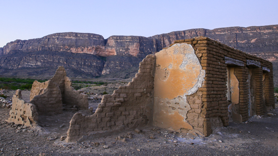
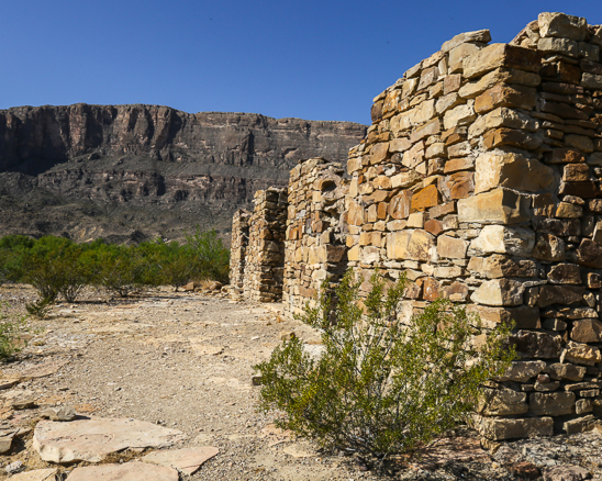
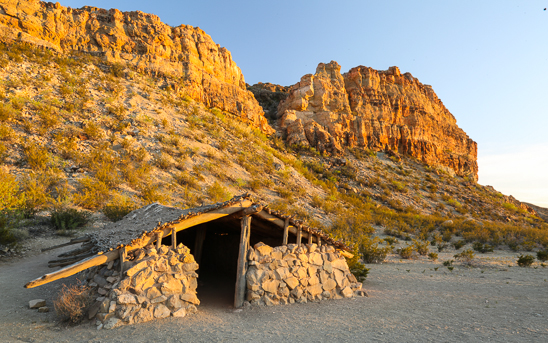
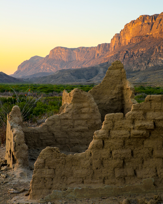
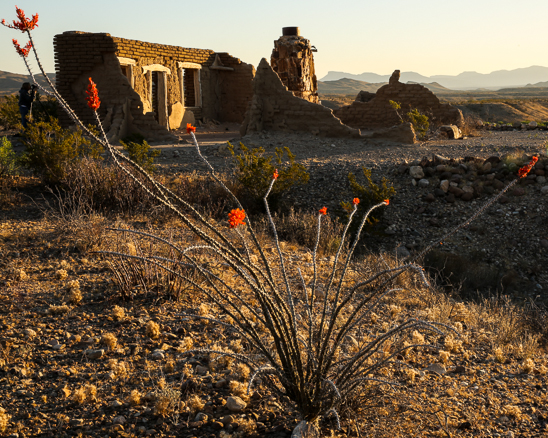 All the images in this post were captured at the Dorgan-Sublette Ruins a short walk/hike off the Castolon Road above the Santa Elena Canyon and the Rio Grande River.
Expanded Big Bend NP Image Gallery
Big Bend National Park – Vol 2
Big Bend National Park – Vol 3

